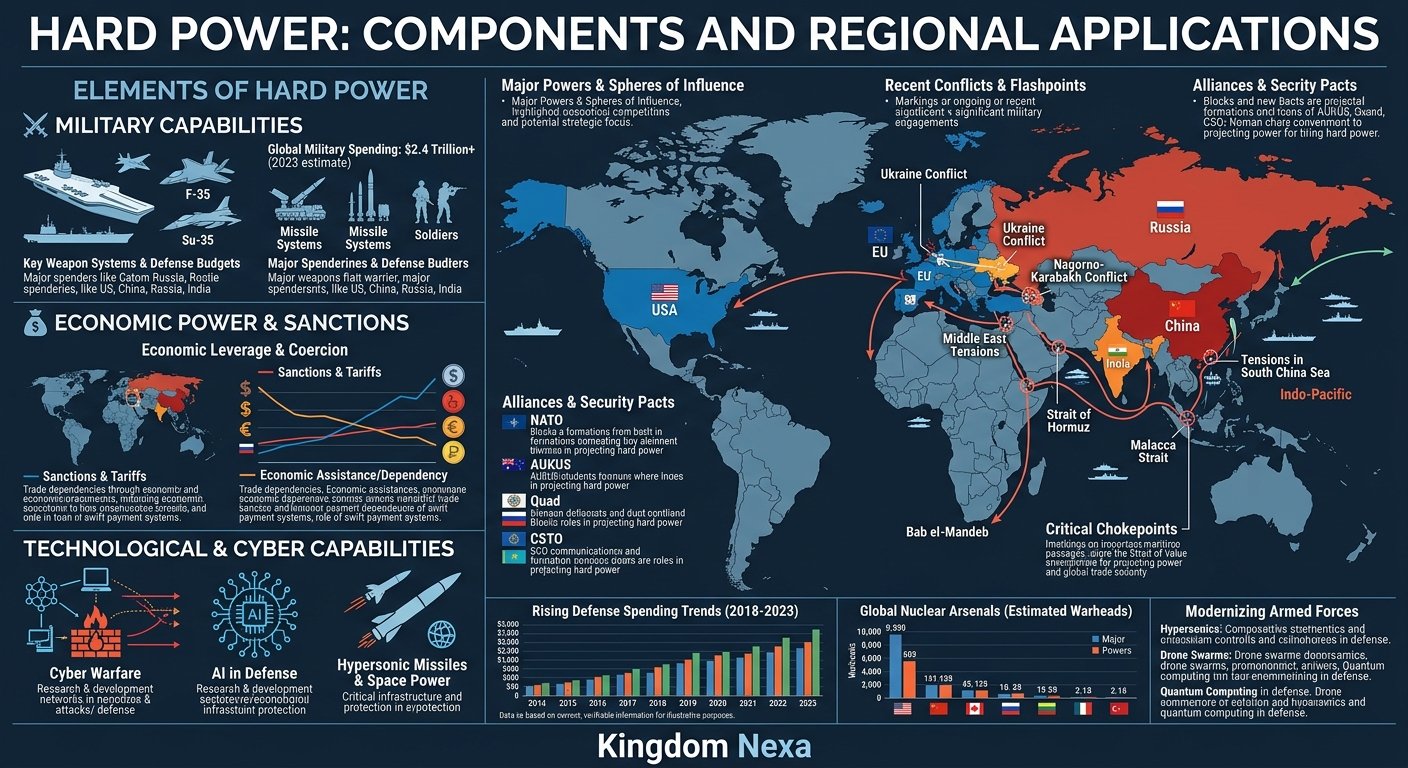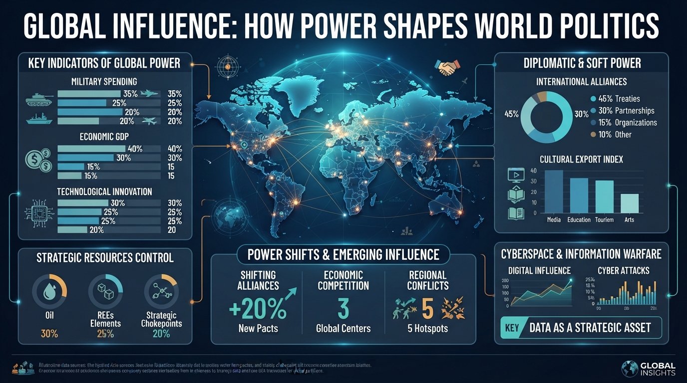
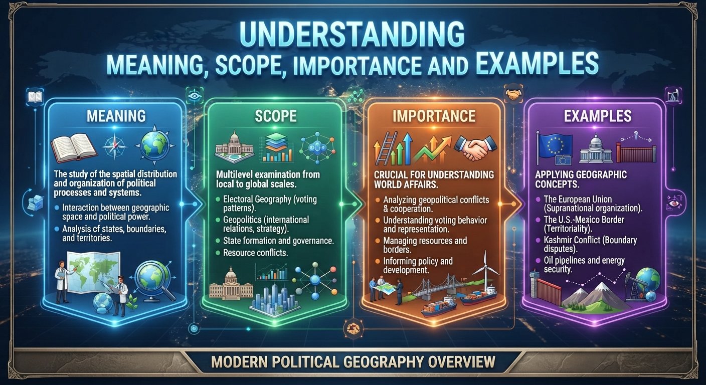
Political geography is the study of how power, politics, territory, borders, states, people, and places interact across geographic space. It helps explain why countries have particular boundaries, why territorial disputes emerge, how governments exercise authority, and why geography continues to influence international relations.
The subject extends far beyond drawing borders on a map. Political geography examines the relationship between political power and space at multiple scales—from neighborhoods and cities to states, regions, oceans, and the global system. It also considers citizenship, migration, nationalism, territoriality, sovereignty, resource control, political identities, and the changing nature of borders.
This makes political geography particularly important for understanding international geopolitics and global affairs. Geography provides the spatial context in which political decisions occur, while political institutions and power can also reshape geographical spaces. The Royal Geographical Society describes political geography as encompassing themes such as space and power, conflict and security, citizenship, territoriality, states and the state system, political economy, and social movements. (Royal Geographical Society)


What Is Political Geography?
Political geography is a branch of human geography concerned with the relationship between political processes and geographic space.
In simple terms, it asks questions such as:
- Where is political power located?
- How are territories created and controlled?
- Why do borders exist where they do?
- How do states exercise sovereignty?
- Why do territorial disputes occur?
- How do geography and resources influence political decisions?
- How do migration and nationalism affect political territory?
- How do global institutions influence states and regions?
Political geography therefore connects geography with political science, international relations, history, economics, sociology, law, and geopolitics.
Geography itself provides a framework for understanding places, spatial relationships, interconnected societies, and the differences between regions. Political geography applies this spatial perspective specifically to questions of political organization and power. (Royal Geographical Society)
Political Geography Definition
A useful definition is:
Political geography is the study of how political power, institutions, territories, borders, identities, and governance are organized across geographical space.
The definition includes both physical and human dimensions. Mountains, rivers, coastlines, oceans, natural resources, and strategic locations can influence political relationships, while states, governments, borders, laws, and populations shape how geographic space is governed.
Political Geography vs. Geopolitics
Geopolitics are closely connected but are not identical.
Political geography has a broad focus on the spatial organization of political life. It examines territory, borders, states, citizenship, political identities, elections, governance, and relationships between power and space.
Geopolitics more specifically examines how geographical factors influence international politics, foreign policy, strategic competition, and relations between states.
The Royal Geographical Society identifies geopolitics as a subdisciplinary area within political geography. (Royal Geographical Society)
In practice, the two fields often overlap. A political geographer may study how borders are produced and experienced, while a geopolitical analyst may examine how those borders affect security and strategic competition.
Why Is Political Geography Important?
Political geography matters because political decisions are never made in an abstract space. Governments operate over territories, populations, borders, cities, coastlines, airspace, and maritime zones.
Geographical location can influence economic opportunities, military vulnerability, access to resources, transportation routes, and diplomatic relationships.
Political geography therefore helps explain why apparently similar countries can face very different political and strategic circumstances.
Geography and Political Power
Power is unevenly distributed geographically.
A state located beside a major sea route may have different strategic opportunities from a landlocked state. A country controlling a narrow maritime passage can possess influence that exceeds its physical size. A state positioned between rival powers may face strategic pressure while simultaneously gaining diplomatic importance.
Political geography examines these relationships rather than assuming geography automatically determines political outcomes.
Geography and National Interests
National interests are shaped partly by geographical circumstances.
Governments may prioritize:
- Territorial integrity
- Border security
- Access to oceans
- Energy supplies
- Water resources
- Trade corridors
- Strategic infrastructure
- Population centers
- Agricultural land
- Natural resources
- Regional influence
Geography does not determine national policy by itself, but it creates opportunities, constraints, risks, and strategic choices.
What Are the Main Concepts of Political Geography?
Political geography contains several fundamental concepts that help explain how political space is organized.
Territory
Territory refers to a geographical area over which political authority is exercised or claimed.
For modern states, territory is closely associated with sovereignty. Governments seek to establish control over land, populations, borders, and institutions within their recognized jurisdiction.
Territory can also be contested. Competing claims may produce diplomatic disputes, political tensions, or armed conflict.
Sovereignty
Sovereignty refers broadly to the authority of a state to govern its territory and conduct its affairs without being subject to another state’s superior authority.
Modern international relations are heavily structured around sovereign states and their territorial claims. The international system, however, also contains institutions, treaties, legal obligations, and organizations that constrain or influence state behavior.
Borders
Borders separate political jurisdictions.
They may follow:
- Rivers
- Mountains
- Coastlines
- Surveyed lines
- Historical boundaries
- Colonial-era arrangements
- Ethnic or linguistic divisions
- Political agreements
Not every political border corresponds to a natural geographic feature. Some boundaries are essentially products of historical and political decisions.
Political geography therefore asks not simply where a border is, but why it exists, who created it, how it is maintained, and how people experience it.
Territoriality
Territoriality refers to the ways individuals, groups, and institutions seek to control, organize, or influence geographic space.
States are the most obvious territorial actors, but territorial behavior can also involve communities, corporations, political movements, armed groups, and other organizations.
Place
Place is more than a physical location. It can carry historical, cultural, political, and emotional meanings.
People may associate territories with identity, belonging, memory, security, or national pride. This relationship between identity and place can become politically important, particularly when governments or political movements use territorial identity to mobilize populations. (Royal Geographical Society)
How Did Political Geography Develop?
Political geography developed alongside the broader development of modern geography, state systems, imperial expansion, nationalism, and international politics.
Early Geographic Understandings of Political Space
Governments have always been concerned with territory.
Ancient kingdoms and empires mapped land, controlled strategic routes, established administrative divisions, and defended frontiers. Geography was therefore connected to political authority long before political geography became a formal academic discipline.
Colonialism and Political Boundaries
European imperial expansion profoundly influenced the political geography of Africa, Asia, the Americas, and other regions.
Colonial governments frequently imposed administrative boundaries that did not necessarily correspond to existing cultural, linguistic, economic, or political geographies.
Some contemporary territorial and political challenges can only be understood by examining these historical processes.
Nationalism and the Modern State
The rise of nationalism strengthened the idea that political communities should be associated with defined territories and sovereign states.
As national identities became politically influential, questions about who belonged to a territory and who had authority over it became increasingly important.
Post-World War II Political Geography
After the Second World War, decolonization dramatically transformed the global political map.
New states emerged across Asia, Africa, the Middle East, and elsewhere. At the same time, international organizations and international law became increasingly important in managing relations between states.
The resulting political map contains both historical continuities and major transformations.
How Do Borders Shape International Politics?
Borders are among the most visible expressions of political geography.
They determine where governments exercise jurisdiction and influence how people, goods, capital, and information move.
International Borders
International borders define the territorial limits of states.
They can facilitate political administration and security, but they can also become sources of tension when:
- Two governments claim the same territory.
- Historical boundaries are disputed.
- Communities are divided by state borders.
- Natural resources cross borders.
- Rivers or maritime areas are contested.
- Political identities conflict with territorial arrangements.
Maritime Boundaries
Political geography extends beyond land.
Oceans contain strategically important spaces involving:
- Territorial seas
- Exclusive economic zones
- Continental shelves
- Fisheries
- Energy resources
- Shipping routes
- Naval access
This makes maritime political geography increasingly important to international security and economic competition.
Borders and Everyday Life
Borders do not affect only governments.
They influence:
- Migration
- Trade
- Tourism
- Family relationships
- Employment
- Security
- Access to services
- Cross-border communities
A border may be highly visible politically while being relatively permeable economically, or it may become heavily controlled during periods of conflict or political tension.
How Does Political Geography Influence Geopolitics?
Political geography provides much of the spatial foundation for geopolitical analysis.
A country’s geographical position can affect its strategic calculations, but geography should never be treated as destiny.
Strategic Location
Some locations have greater strategic significance because they connect important regions or transportation routes.
Examples include:
- Major ports
- Mountain passes
- River crossings
- Narrow maritime passages
- Border corridors
- Railway junctions
- Energy transit routes
Control or influence over strategically located spaces can generate economic or security advantages.
Landlocked States
Landlocked countries face particular geographical constraints because they lack direct access to the ocean.
They often depend on neighboring states for transport corridors and access to international markets. Political relations with transit countries can therefore have significant economic consequences.
Chokepoints
Geographic chokepoints are narrow passages through which significant movement must pass.
Their strategic importance can arise from their role in:
- Maritime commerce
- Energy transportation
- Military movement
- Regional connectivity
Disruptions at major chokepoints can therefore have consequences extending far beyond the surrounding region.
What Role Does Political Geography Play in Conflict?
Territory is one of the most persistent sources of political conflict.
Territorial disputes can involve sovereignty, resources, national identity, strategic depth, historical claims, or access to transportation routes.
Territorial Disputes
A territorial dispute occurs when competing actors disagree about control or sovereignty over a geographical area.
Such disputes may remain diplomatic for decades or escalate into confrontation.
Political geography helps analysts examine:
- The location of disputed territory
- Its strategic importance
- Population distribution
- Historical claims
- Resource value
- Military geography
- Neighboring states
- International legal arguments
Geography and Military Strategy
Terrain affects military operations.
Mountains, deserts, forests, rivers, coastlines, urban areas, and climate can influence mobility, logistics, surveillance, and defense.
Modern military geography also includes technological dimensions such as satellites, drones, precision weapons, cyber infrastructure, and communications networks.
The importance of geography has therefore not disappeared in the digital era. Instead, the meaning of strategic space has expanded.
How Does Political Geography Affect Economics?
Political geography and political economy are closely connected.
Economic activity depends heavily on location and connectivity.
Trade Routes
International trade depends on ports, roads, railways, shipping lanes, pipelines, airports, and border crossings.
Countries located along important transportation corridors may gain economic and strategic significance.
Natural Resources
Resources such as oil, gas, minerals, freshwater, and fertile agricultural land can influence political relationships.
Resource-rich regions may attract investment but can also experience competition over ownership, taxation, environmental regulation, or political control.
Infrastructure and Connectivity
Modern infrastructure can transform political geography.
Major projects such as:
- Ports
- Railways
- Highways
- Pipelines
- Electricity grids
- Telecommunications networks
- Data centers
can increase connectivity between regions while also creating new strategic dependencies.
Political geography therefore helps explain why infrastructure is often simultaneously an economic and geopolitical issue.
What Is the Relationship Between Political Geography and Nationalism?
Nationalism often has a strong geographical dimension.
National movements commonly connect political identity with territory, homeland, historical memory, and cultural space.
A population may consider a particular territory central to its collective identity even when political control over that territory is contested.
This can create powerful political claims involving:
- Self-determination
- Sovereignty
- Independence
- Autonomy
- Territorial integrity
- Minority rights
The relationship between identity and territory is complex. Political geography studies how these ideas are constructed, contested, and transformed rather than assuming that political borders naturally correspond to cultural identities.
How Does Migration Change Political Geography?
Migration can reshape political geography at local, national, and international scales.
People move because of:
- Employment
- Education
- Family
- Conflict
- Political persecution
- Economic conditions
- Environmental pressures
- Climate-related risks
Large migration movements can influence electoral politics, border policy, urban development, labor markets, and debates about national identity.
Political geography therefore examines both the physical movement of people and the political responses to that movement.
The interaction between fixed territorial systems and mobile flows is a major theme in contemporary geographical analysis. The Royal Geographical Society highlights the tension between state systems based on territorial sovereignty and flows of people, money, ideas, technology, and resources that cross borders. (Royal Geographical Society)
What Is the Role of Political Geography in International Relations?
Political geography provides an important spatial dimension to international relations.
International relations traditionally focuses on interactions among states and other international actors. Political geography adds questions about where those interactions occur and how territory affects them.
Alliances and Regional Security
Countries frequently form alliances or partnerships based partly on geographical proximity and shared strategic concerns.
Neighboring states may cooperate because they face common threats, while distant states may develop partnerships because of economic or strategic interests.
Diplomatic Geography
Diplomacy also has a geographical dimension.
The location of embassies, international organizations, military bases, capitals, ports, and diplomatic meeting places can influence international relationships.
Political geography can therefore examine diplomacy not only as negotiation but also as a spatial practice.
International Organizations
Organizations such as the United Nations and regional institutions operate within a world structured by territorial states.
Their decisions can affect borders, sovereignty, development, security, migration, and international cooperation.
Political geography helps explain the relationship between these institutions and the territorial state system.
How Is Technology Changing Political Geography?
Technology has changed how governments control, monitor, and interact with territory.
Modern political geography increasingly incorporates:
- Satellite imagery
- Geographic information systems
- Artificial intelligence
- Cybersecurity
- Digital mapping
- Drones
- Digital communications
- Remote sensing
- Online political networks
Digital Territory
Political power increasingly extends into digital environments.
States seek to regulate data, communications networks, online platforms, digital infrastructure, and cybersecurity.
This creates an important question: Can political territory remain purely physical when so much economic and political activity occurs digitally?
The answer is increasingly complex.
Physical geography remains fundamental, but digital networks create new forms of spatial power that operate across traditional borders.
Why Is Political Geography Important for Businesses?
Businesses increasingly need to understand political geography because political decisions can affect supply chains, market access, infrastructure, investment, and regulatory conditions.
Political-risk professionals may examine:
- Border instability
- Sanctions
- Trade restrictions
- Infrastructure security
- Political transitions
- Resource availability
- Regional conflicts
- Regulatory differences
- Transport corridors
- Strategic dependencies
For multinational companies, geography can therefore become a central component of risk management.
What Are the Major Contemporary Issues in Political Geography?
Political geography continues to evolve as the international system changes.
Important contemporary issues include:
Border Security
Governments continue to debate how borders should be managed while balancing security, trade, migration, and humanitarian obligations.
Resource Competition
Competition over energy, minerals, freshwater, food, and strategic infrastructure can create new geopolitical pressures.
Climate Change
Climate change can affect migration, resource availability, coastal areas, agriculture, and political stability.
Urban Political Geography
Cities are increasingly important centers of political and economic power.
Large metropolitan areas can influence national politics while also experiencing their own challenges involving inequality, housing, transportation, migration, and governance.
Arctic Geopolitics
The Arctic has increasing strategic importance because of changing environmental conditions, resources, transportation possibilities, and the interests of Arctic and non-Arctic powers.
Critical Infrastructure
Ports, energy networks, telecommunications systems, undersea cables, satellites, and digital infrastructure have become increasingly important elements of national resilience and strategic competition.
How Can Students Analyze Political Geography?
A useful political geography analysis should begin with location but should not stop there.
Ask the following questions:
- Where is the political issue occurring?
- Who controls the territory?
- Who claims it?
- What historical events shaped the current geography?
- What resources or strategic advantages are involved?
- Which populations live there?
- How do identities influence political claims?
- Which international laws or agreements apply?
- Which external powers have interests in the region?
- How could the situation affect neighboring countries and the wider international system?
This approach transforms a simple map into a deeper analysis of power, territory, interests, and consequences.
Political Geography vs. Physical Geography vs. Human Geography
Political geography is easier to understand when compared with related fields.
| Field | Main Focus |
|---|---|
| Physical Geography | Natural landscapes, climate, landforms, water, and environmental processes |
| Human Geography | People, societies, cultures, economies, and spatial relationships |
| Political Geography | Politics, territory, borders, states, power, governance, and spatial organization |
| Geopolitics | How geography influences international power and strategic relations |
These areas overlap. Political geography, for example, may examine how a river becomes an international boundary, while geopolitics may examine how control of that river affects relations between neighboring states.
Why Political Geography Matters in the Modern World
Political geography remains essential because the world is simultaneously becoming more interconnected and politically contested.
Goods, money, information, technology, and people cross borders rapidly, yet states continue to organize much of political authority around territorial boundaries.
This creates a fundamental tension between territorial control and global interconnectedness.
Political geography helps explain that tension.
It also demonstrates why maps are not merely neutral representations of physical space. Maps can reflect political decisions about boundaries, sovereignty, identity, administration, and power. Even seemingly technical geographic arrangements can carry political consequences; the Royal Geographical Society, for example, notes how political decisions have shaped time-zone boundaries in ways that do not always follow purely geographic patterns. (Royal Geographical Society)
For international geopolitics, this perspective is invaluable. Geography creates the spatial context, but political actors determine how that space is interpreted, governed, contested, and transformed.
Frequently Asked Questions About Political Geography
What is political geography in simple words?
Political geography is the study of how politics and power are connected to geographical space. It examines states, borders, territories, sovereignty, populations, political identities, and relationships between governments and places.
What is the main focus of political geography?
Its central focus is the relationship between power and space. Political geographers examine how political authority is organized geographically and how territory, borders, identity, resources, and location influence political processes.
What is the difference between political geography and geopolitics?
Political geography is broader and examines the spatial organization of political life at different scales. Geopolitics focuses more specifically on how geography influences international relations, strategic competition, and state power.
Why are borders important in political geography?
Borders define political jurisdictions and influence sovereignty, security, migration, trade, identity, and international relations. Disputed borders can also become sources of diplomatic tension or conflict.
How does geography affect politics?
Geography can influence access to resources, transportation routes, markets, oceans, strategic locations, and neighboring states. However, geography does not determine political outcomes by itself; institutions, leadership, technology, economics, and historical circumstances also matter.
Why is political geography important in international relations?
It helps explain how territory, strategic location, borders, resources, and regional relationships influence the behavior of states and other international actors.
How does political geography affect economic development?
Geographical location can influence access to markets, ports, resources, infrastructure, transportation networks, and neighboring economies. Political boundaries and regulations can either facilitate or restrict these connections.
What are examples of political geography?
Examples include international borders, territorial disputes, maritime boundaries, migration patterns, federal political divisions, disputed territories, resource competition, electoral geography, and the strategic importance of transportation corridors.
Is political geography still important in the digital age?
Yes. Technology has changed how power operates, but physical territory remains important. At the same time, digital networks, satellites, cybersecurity, and data infrastructure have created additional dimensions of political space.
Conclusion
Political geography provides a powerful framework for understanding how territory, power, borders, identity, resources, and political institutions interact. It explains why geography continues to matter even in an increasingly interconnected world.
From international borders and territorial disputes to migration, trade corridors, resource competition, military strategy, and digital infrastructure, political decisions are deeply connected to space.
The most important lesson is that geography does not operate as an unavoidable destiny. Mountains, oceans, borders, resources, and strategic locations create opportunities and constraints, but governments and societies interpret and respond to them through political institutions, economic choices, diplomacy, technology, and power.
For anyone studying international geopolitics and global affairs, political geography provides an essential foundation. It turns the question from simply “Where is something?” into the more important questions: “Who controls it, why does it matter, how did it become politically significant, and what consequences does that geography create?